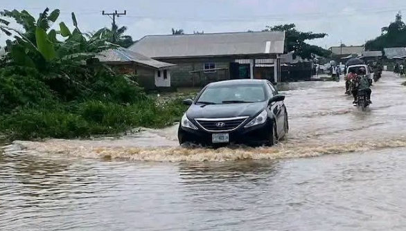
The Nigeria Hydrological Services Agency (NIHSA) has placed 17 states on medium flood alert, warning that rising river levels could trigger widespread flooding in vulnerable communities within the next seven days.
The agency urged state governments, emergency agencies and residents living in flood-prone areas to begin immediate evacuation from floodplains, cautioning that delays could lead to loss of lives, destruction of infrastructure and worsening humanitarian conditions.
The warning was contained in the agency’s National Flood Advisory (Alert No. NFA-2026-200), which covers the period from July 21 to July 27.
According to NIHSA, hydrological data collected from its nationwide monitoring network revealed that water levels at 16 key river gauging stations have risen above both watch and warning thresholds, signalling an increased risk of localised flooding.
Director-General of NIHSA, Umar Mohammed, said monitoring stations at Saminara on the Karam River, Waya Dam Site on the Waya River and Amber on the Amber River were among those recording critical water levels.
He warned that communities located along major river channels face imminent flooding and called for swift preventive action.
“Our hydrological monitoring network shows that river levels have exceeded critical thresholds. Communities along the affected river channels are at immediate risk of localised flooding, and all stakeholders must act without delay,” he said.
The agency identified Bauchi, Edo, Imo, Kaduna, Plateau and Benue among the states facing heightened flood threats, while 11 other states remain under close surveillance as water levels continue to rise.
Bauchi recorded the highest projected impact, with 1,841 communities considered vulnerable. The state also has 145 schools, 101 health facilities and eight markets located within areas expected to be affected if flooding occurs.
In Imo State, NIHSA projected that 415 communities, 423 schools, 198 health facilities, 49 markets, 111 religious centres and 75 hectares of farmland could be impacted.
For Edo State, the agency identified 148 at-risk communities, alongside 131 schools, 123 health facilities, four markets, seven religious centres and seven hectares of farmland.
Plateau State was projected to have 205 vulnerable communities, as well as 137 schools, 44 health facilities, 16 markets, 81 religious centres and 64 hectares of farmland within the potential flood zone.
Kaduna State has 168 communities, 16 schools and three health facilities identified as vulnerable, while Benue has five communities, eight schools and two health facilities facing possible flood impacts.
Beyond urging residents to relocate from flood-prone locations, NIHSA directed the National Emergency Management Agency (NEMA), State Emergency Management Agencies (SEMAs) and local authorities to immediately pre-position food supplies, clean water, medical materials and other emergency relief items in safe locations to ensure rapid response if flooding occurs.
The agency also advised motorists and pedestrians to avoid flooded roads and bridges, warning that attempting to cross submerged routes could prove fatal.
It further called on state and local authorities to clear blocked drainage systems and waterways to improve water flow and minimise the risk of urban flooding.
NIHSA said continuous monitoring of river levels would continue across the country and assured the public that additional advisories would be issued as conditions evolve.